As part of the DPW (Department of Public Works), the Planning Department works directly with other Burning Man departments to address a multitude of interlinked responsibilities each year. Our small staff is largely composed of volunteers from a wide geographic area, requiring that we communicate and share work primarily via the Internet.
Beginning in early fall 2001, we began working on a series of graphic design projects including various two- and three-dimensional architectural renderings, and a first for us—designing a coin. Representing our forthcoming event, these graphics were later featured on our website, as well as in our color newsletter.
The annual meeting of the Planning Committee occurs in early January. This group reviews the general plans and ideas related to the Nevada property, the event’s theme, anticipated changes in building the city, and any possible new BLM permit modifications that have come out of the post-event Cooperators Meeting. This committee doesn’t usually need to convene throughout the year, as members work one on one with the various responsible departments to realize the goals agreed upon at the annual meeting.
For 2002, the Planning Department worked in collaboration with Larry Harvey to create a design for the forty-foot high Light House. Like the tower structure of 2001, this construction “served as a lofty pedestal for the Man, and as its pyre during the event’s finale.”
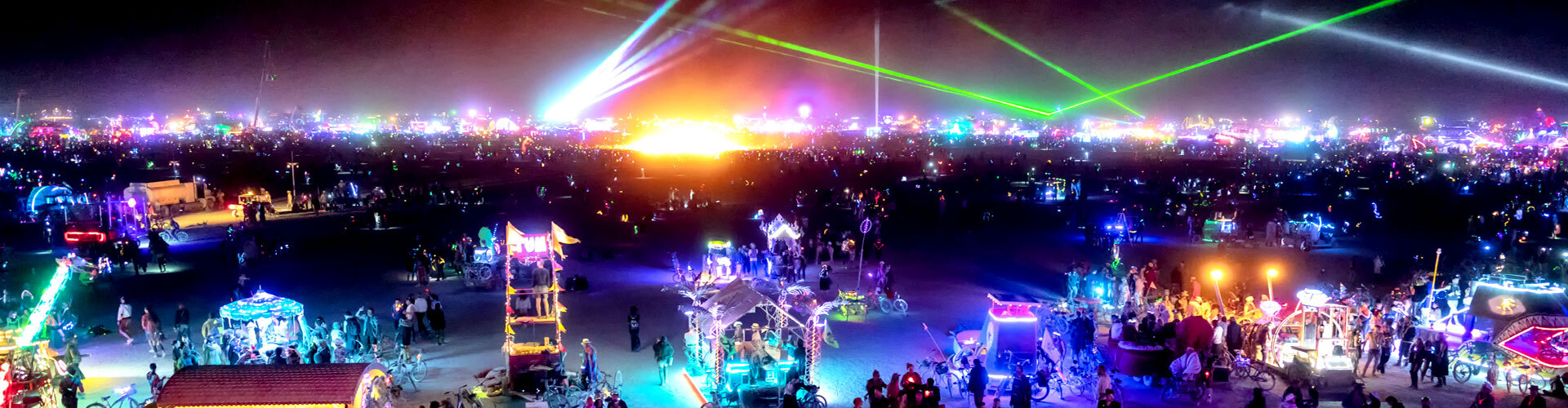
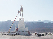 The Light House stood as a tiered monument, its twelve facets each marking 30 degrees of the compass. At each median, an angled bench pointed out radial streets at 15 degree intervals. The Light House also incorporated powerful laser beams that marked the cardinal directions in the night sky. Ladders wound through the interior connecting to an observation deck at the top. With Burning Man astride it, this landmark became the locus of our city.
In addition to the annual routine of refining and enhancement of the city plan, we also developed and produced the extensive maps, plans, and operating data that provide vital guidance to other departments. We also provided all the required maps and data for our annual permit application to the Bureau of Land Management.
These documents spanned a broad range from describing the city’s longitude and latitude declinations in the Black Rock Desert to working drawings for construction of the structures, even down to plans for some individual campsites. These drawings were produced in AutoCAD for PC and in Apple/Mac compatible CAD format, and some were rendered in formats suitable for incorporation into publications.
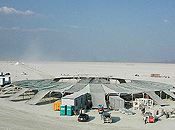 After completing the planning stage, we set up field operations early at the empty desert site to help supervise the survey work and construction and to offer continuing on-site development work as needed during Black Rock City’s re-emergence. Again, we refined the plans and supervised the re-construction of the 38,000-square-foot café (an innovative structure we designed for the 2000 event) and the Camp Arctica dome. We helped oversee the erection of the Light House and other event structures planned by us.
Over the year, we did a good deal of work for other DPW projects. This ranged from small building design projects and supervision to further planning of the Black Rock Station work ranch and development of Frog Pond water resources.
Planning sometimes benefits from introduction of new technological tools. We continued working with the grid system we conceived and initiated for the 2001 event to aid the allocation and placement of theme camps. We also helped in the development of a computer program using the grid system to map these sites. We have continued assisting in further refinements of this program to improve the indicators of space allocated to a theme camp. Although the program fell short of assisting in physical placement, it is able to keep a permanent and printable record in its updatable database.
Additionally, we worked with staff to produce an electronic map of art installation sites on the open playa. This data was then translated into a small program we initially proposed and then helped to develop. The data could then be uploaded to a handheld Global Positioning System unit, enabling the site locators to “virtually” walk artists to their sites using GPS. In addition to speeding the art placement process, this technology provides the potential for greater accuracy than before. It also provided a permanent record of the location, encouraging participants to be responsible for leaving their sites in good order.
We believe this computerized mapping approach has many future applications in Black Rock City. Early in the year, we worked with a group of programmers who are now developing a relational database and supporting software that will eventually make this technology available to all participants. We envision an on-site Wi-Fi network and interactive electronic information kiosks where location data, messages, photos, etc., may be uploaded and viewed.
As with other parts of the Burning Man experience, we never know what to expect next, but we eagerly look forward to our new challenges.
Submitted by,
Rod Garrett, City Designer